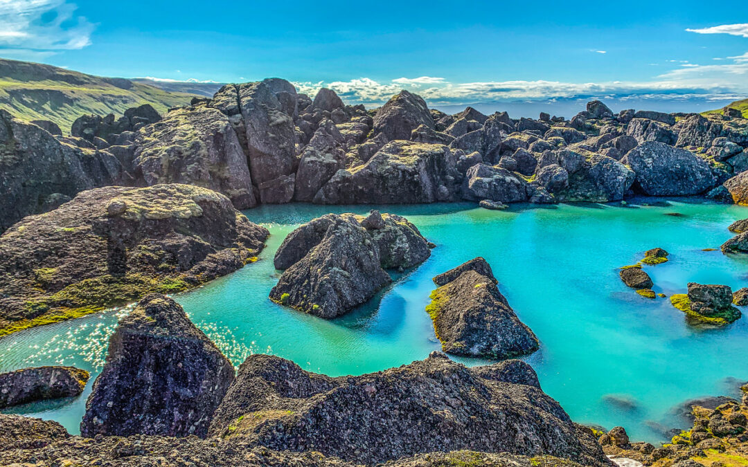
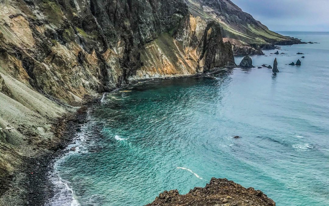
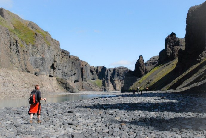
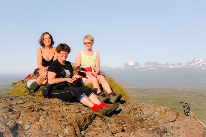
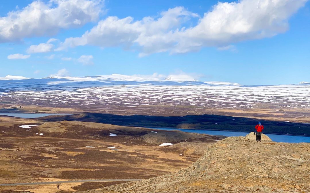
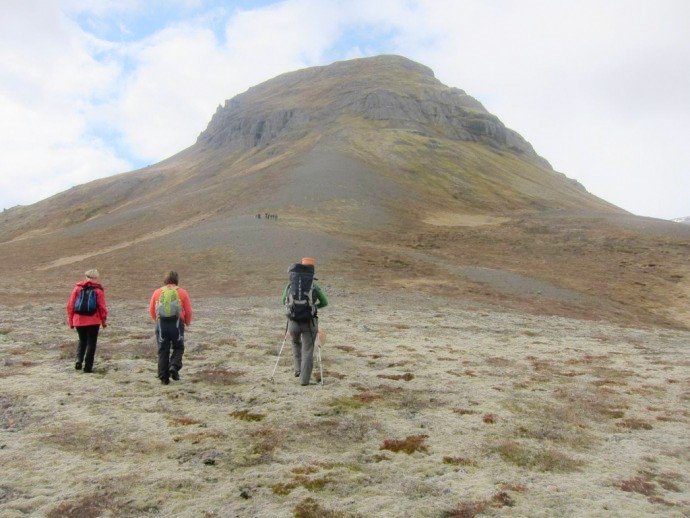
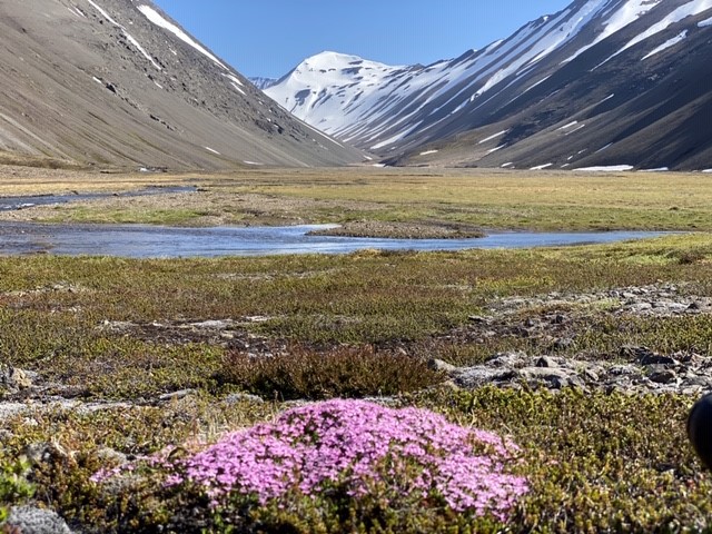
3.2.Stórurð (“The Giant Boulders”) (N65°30,88-W13°59,79) Stórurð is one of Iceland’s greatest natural wonders. Stórurð lies below the small glacier west of Dyrfjöll mountain. It was formed by giant rocks that the glacier broke from the mountain and carried a long way...
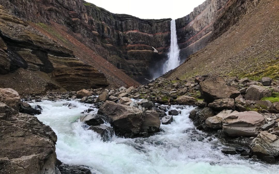
Hengifoss (N65°04.41-W14°52.84 start) // 2 hrs. The top part of the trail to Hengifoss can be affected due to spring conditions.The shorter hike up to beautiful Litlanesfoss is open and a little bit further up. Hengifoss is one of the highest waterfalls in Iceland and...
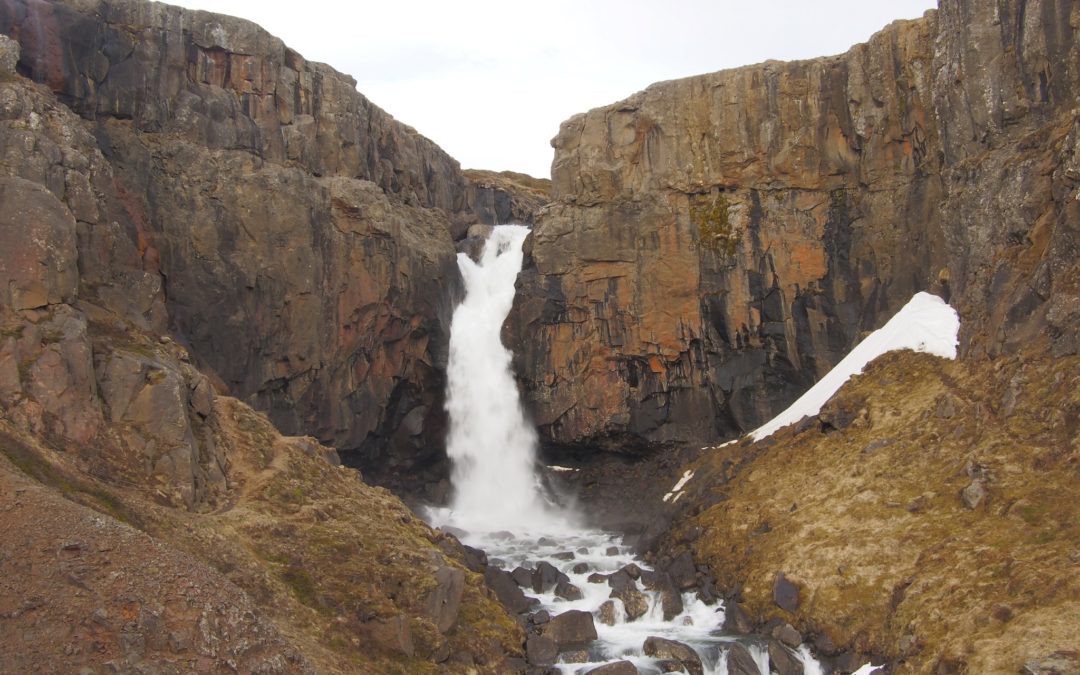
Fardagafoss (N65°16.06-W14°19.96) // 1.5 hrs. Fardagafoss is a waterfall located just outside of Egilsstaðir on the route towards Seyðisfjörður town. It winds its way up the mountainside of Fjarðarheiði heath. The ascent from the parking area (located only 6 km from...
(N65°38.775-W14°14.670) Húsey is 55 km north of Egilsstaðir and located between the rivers, Jökulsá á Dal (Brú) and Lagarfljót. A hike on to the plains out of the Húsey farm, out by Héraðsflói bay offers a splendid view of the surrounding mountains and opportunities...
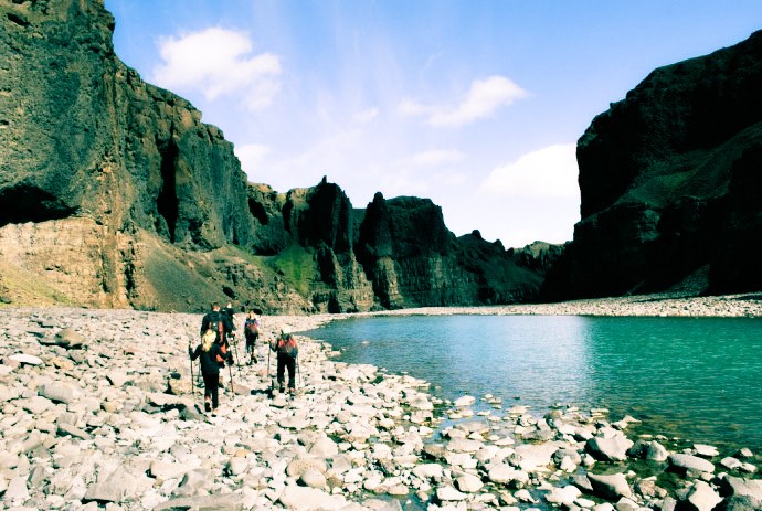
Hafrahvammar / Dimmugljufur canyon (N64°99.252-W15°71.683) Hafrahvammar is one of the 30 Pearls of Egilsstaðir region and refers to some of the most stunning hikes of the area. Drive north of the dam of Kárahnjúkar reservoir along a gravel road fit for...
Þerribjarg (Therribjarg) (N65°45.336-W14°20.990) // Difficult // 5 – 6 hrs Þerribjarg is one of the 30 Pearls of Egilsstaðir region and refers to some of the most stunning hikes of the area. Drive the main road up Hellisheiði mountain and when you’ve reached...
Landsendi (N65° 43.352-W14°23.300) // 2 hrs. Landsendi is one of the 30 Pearls of Egilsstaðir region and refers to some of the most stunning hikes of the area. The name of Landsendi refers to the remoteness of this place – “The End of the Land”. Walk from the road...
Hvannárgil (N65°16.868-W15°47.418) // 4 klst. Hvannárgil is one of the 30 Pearls of Egilsstaðir region and refers to some of the most stunning hikes of the area. This spectacular canyon almost cuts the mountain range of Möðrudalur in two. It is divided into three...
Magnahellir (N64°99.252-W15°71.683) // 0.5 hrs. Magnahellir is one of the 30 Pearls of Egilsstaðir region and refers to some of the most stunning hikes of the area. To reach this magnificent canyon, drive north of Kárahnjúkastífla reservoir until you come to...
Eiriksstadahneflar (N65°08.617-W15°28.195) // 5-6 hrs. Eiríksstaðahneflar is one of the 30 Pearls of Egilsstaðir region and refers to some of the most stunning hikes of the area. On this hike you will get two for one as actually the mountains are two. This hike...
Hnjúksvatn (N65°14.333-W15°15.887) // 3 hrs. Hnjúksvatn is one of the 30 Pearls of Egilsstaðir region and refers to some of the most stunning hikes of the area. It is a lake on the heath across from Merki farm. The plateau on which the lake is located, is...
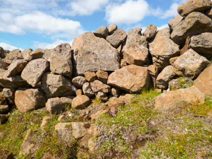
Grjótgarður – the Stone Wall at Hjardarhagi (N65°21.391-W15°00.061) // 2.5 hrs. The Stone Wall is one of the 30 Pearls of Egilsstaðir region and refers to some of the most stunning hikes of the area. This hike takes approx. two and a half hours, it is fairly...
Heiðarendi (N65°23.085-W14°33.819) // 2-3 hrs Heiðarendi is one of the 30 Pearls of Egilsstaðir region and refers to some of the most stunning hikes of the area. Heiðarendi means “The End of the Fljótsdalur Heath”. It is a lovely walk in the higlands. Drive up to and...
Sandfell (N65°05.637-W14°30.298) // 5 hrs. Sandfell is one of the 30 Pearls of Egilsstaðir region and refers to some of the most stunning hikes of the area. Sandfell is an impressive looking rhyolite mountain in the shape of a ridge and reminds one of a tent because...
Spanarhóll (N65°15.588-W14°41.446) // 5 hrs.Spanarhóll is one of Egilsstaðir’s Pearls, which refers to 30 stunning hiking trails in the region surrounding Egilsstaðir. The phenomenon are four hills that form about 30 meters long series from north to south. The...
Rangarhnjukur (N65°19.410-W14°35.498) // 4 hrs.Rangárhnjúkur is one of Egilsstaðir’s Pearls, which refers to 30 stunning hiking trails in the region surrounding Egilsstaðir. It is most convenient to walk up along the old road from Fjallsel farm. When you arrive there...
Hrafnafell (N65°18,304-W14°29,098) // 2 hrs.Hrafnafell is one of Egilsstaðir’s Pearls, which refers to 30 stunning hiking trails in the region surrounding Egilsstaðir. Drive the gravel road up to Fjallssel farm and to the highest spot south-west of Hafrafell. Walk...
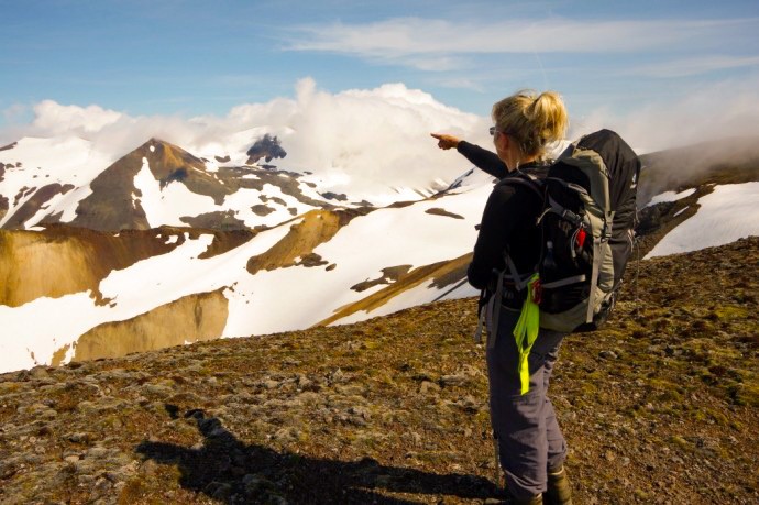
Snæfell (N64°47.846-W15°33.631) // 6 hrs. Snæfell is one of Egilsstaðir’s Pearls, which refers to 30 stunning hiking trails in the region surrounding Egilsstaðir. Mt. Snæfell, which at 1,833 m is the highest mountain in Iceland that is not enclosed by glacier and has...
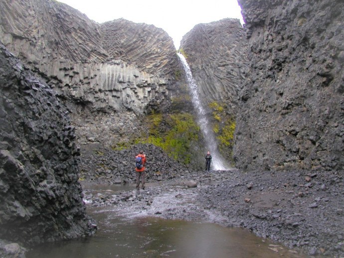
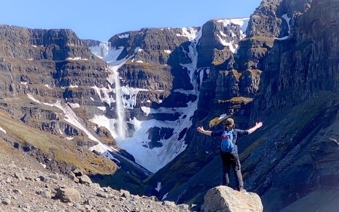
Strútsfoss (N64°54.194-W15°02.314) // 2 hrs. Strútsfoss is one of Egilsstaðir’s Pearls, which refers to 30 stunning hiking trails in the region surrounding Egilsstaðir. It is one of the highest waterfalls in Iceland and is separated in two. The upper part is approx....
Skumhottur (N65°02.548-W14°28.848) // 6 hrs. Skúmhöttur is one of Egilsstaðir’s Pearls, which refers to 30 stunning hiking trails in the region surrounding Egilsstaðir. It is the second tallest mountain in the range between Fljótsdalshérað and Reyðarfjörður. It...
Mulakollur (N65°01.624-W14°38.049) // 3 hrs.Múlakollur is one of Egilsstaðir’s Pearls, which refers to 30 stunning hiking trails in the region surrounding Egilsstaðir. Þingmúli divides Skriðdalurinto Norðurdalur and Suðurdalur. The farm at Þingmúli was a place of...
Stuttidalur (N64°59.173-W14°35.217) // 3 hrs.Stuttidalur is one of Egilsstaðir’s Pearls, which refers to 30 stunning hiking trails in the region surrounding Egilsstaðir. Walk from the sign by the gate close to the road by Haugaá river. The trail is staked. Stuttidalur...
Höttur (N65°07.63-W14°27.25) // 5 hrs.Höttur (Hátúnahöttur) is one of Egilsstaðir’s Pearls, which refers to 30 stunning hiking trails in the region surrounding Egilsstaðir. Höttur is a beautiful mountain which lies in the mountain range between Vellir and Fagridalur...
Bjargselsbotnar (N65°05.465-W14°43.031) // 3 hrs. Bjargselsbotnar is one of Egilsstaðir’s Pearls, which refers to 30 stunning hiking trails in the region surrounding Egilsstaðir. Walk from the Hússtjórnarskóli schoolhouse in the woodlands of Hallormsstaður and follow...
Valtýshellir (N65°06.410-W14°28.517) // 3 hrs. Valtýshellir is one of Egilsstaðir’s Pearls, which refers to 30 stunning hiking trails in the region surrounding Egilsstaðir. Walk from the main road east of Gilsá river (N65°08,172- W14°31.133), pass the ruins...
Rauðshaugur (N65°12.77-W14°23.01) // 3 – 4 hrs.Rauðshaugur is one of Egilsstaðir’s Pearls, which refers to 30 stunning hiking trails in the region surrounding Egilsstaðir. Rauðshaugur is a rock or a hill protruding from the farm Höfði and is visible from a far...
N65°17.102-W14°17.887) // 4 hrsVestdalsvatn is one of Egilsstaðir’s Pearls, which refers to 30 stunning hiking trails in the region surrounding Egilsstaðir. A great trail for hiking which involves crossing Vestdalsheiði mountain range, from Hérað to Seyðisfjörður....
Kóreksstaðavígi (N65°32.782-W14°10.591) // 20 min Kóreksstaðavígi is one of the 30 Pearls of Egilsstaðir region and refers to some of the most stunning hikes of the area. Two abandoned farms, Kóreksstaðagerði and Kóreksstaðirwere built on this beautiful spot where...
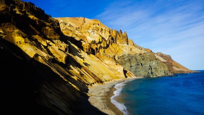
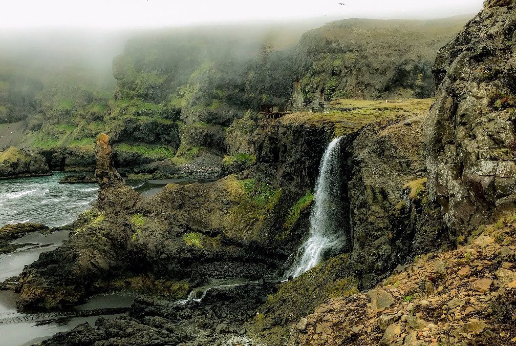
Stapavik (N65°36.17-W13°57.97) // 2-3 hrs Stapavík is an inlet once used as a harbour. From the farm Unaós, which is the most eastern point in Hjaltastaðaþinghá, there is a beautiful trail along the river Selfljót and down the the sea. Along the way you will pass the...