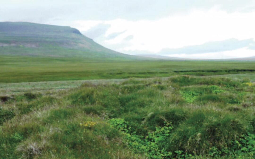
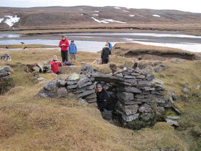
Selsárvellir (N65°40.61-W15°22.92) Selsárvellir, the innermost farm in the Almenningur area, was first settled in the summer of 1860 when Grímur Grímsson and his wife Aldís Jósefsdóttir moved there. They are there in the 1860 census with two children and Grímur ́s...
Mælifell ( N65’41.85-W15’17.98) Mælifell is named in old records; i.e, as owned by the Hof church in Vilking ́s 1397 church register, in a similar register in 1570 and also the record of the 1641 visitation of Skálholt ́s bishop, Brynjólfur. The farm is...
Fossvellir (N65°41.33-W15°22.01) Fossvellir is inland from the farm Mælifell and was a small crofter ́s parcel. The first settler was Björn Guðmundsson of Torfastaðir; permission to settle there is dated April 11th 1861. In the parish census that fall Björn is the...
Aðalból ( N65’41.27-W15’18.44) Aðalból was occupied 1851-1863, and with breaks until 1878. The first settler was Páll Guðmundsson from Hnefilsdalur in Jökuldalur and the farm is first mentioned in the Hof parish census at the end of 1851. In 1852 Páll is...
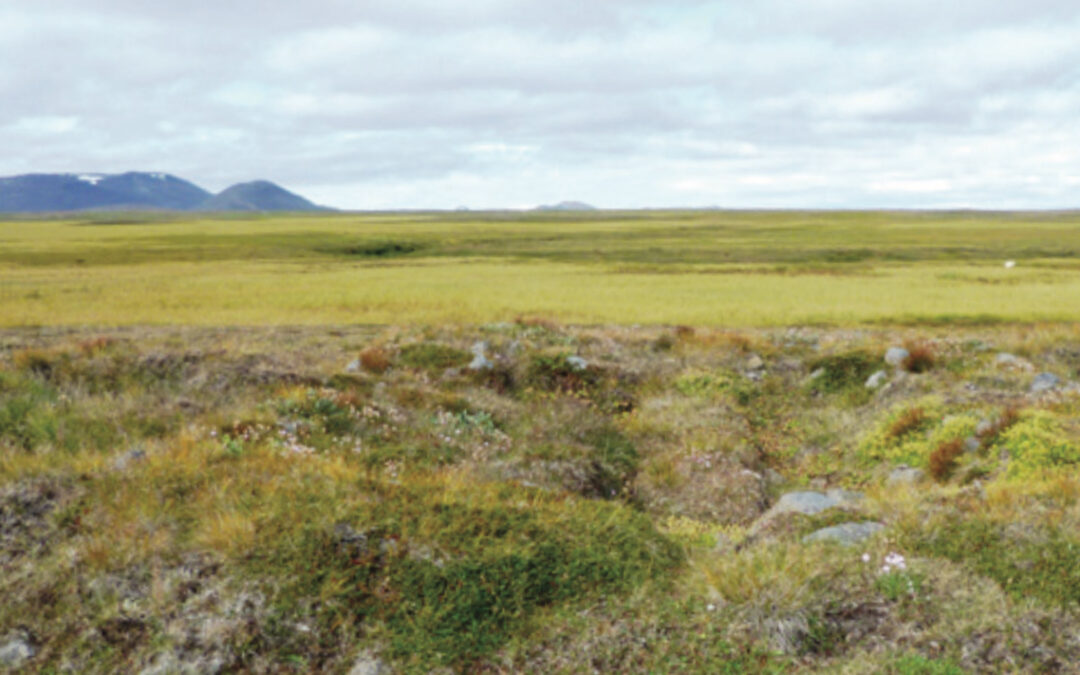
Desjamýri (N65°36.79-W15°20.83) At an elevation of 429 m and with a pleasant view of grassy wetlands and the mountains, Desjamýri stands on a hill on the seaward side of Arnarvatn lake, next to Desjamýrarlækur brook. This farm was established by Matthildur...
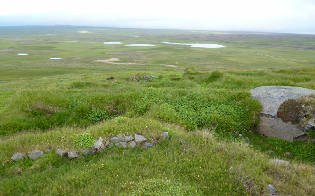
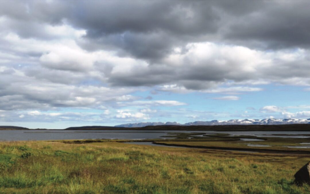
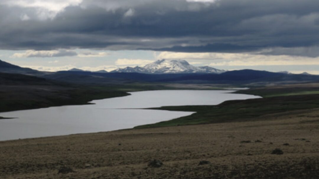
Arnarvatn/Skálamór (N65°35.29-W15°24.05) The large hollow called Brunahvammskvos contains both the Arnarvatn farm site (420 m above sea level) and, on the Vopnafjörður side of the hollow Arnarvatn lake. This hollow lies below the slopes of Kálffell to the east and...
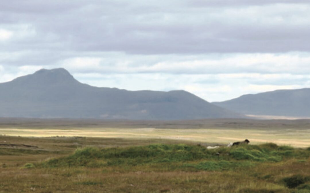
Kálffell (N65°35.26-W15°20.94) Kálffell was a tenant farm belonging to Foss. The farm stood at an altitude of 440 m beside the mountain of the same name, north of Bunguflói and just north and west of the old road to Vopnafjörður. Although the origins of Kálffell are...
Foss (N65°33.78 – W15°16.44) The valley of Hofsá river is named Hofsárdalur up to Steinvarartungusporður, above which it has the name of Fossdalur, home to Foss farm. Located 180 m above sea level, Foss is thought to be a very old farmstead and originally formed...
Brunahvammur (N65°31.62-W15°25.89) This farmhouse stood in the highland side of a grassy, well-drained hollow at an elvation of 340 m, below the slope of Brunahvammsháls. The farm is quite some distance from the Hofsá river, somewhat downstream from the Hölkná river....
Fagrakinn (N65°30.03 – W15°28.80) Fagrakinn was built in 1848 in accordance with the views of Möðrudalur farmers, who considered the land to be part of their estate. The settlers were Guðríður, a daughter of Vigfús, whose family came from Stöðvarfjörður; and...
Melur (N65°28.24-W15°26.95) This farm was founded in 1848, with the first residents considering themselves to be buidling on public land (commons), but the pastor at Hof disagreed. He filed a drawn-out lawsuit which the new farmers lost, and the land reverted to the...
Hólmavatn (N65°27.72-W15°22.09) Hólmavatn was established at an elevation of 522 m in the Vatnaflói wetlands, on the western side of Langhólmavatn lake. The land was taken in 1861 from Skjöldólfsstaðir estate in the northeastern part of Jökuldalsheiði, a part called...
Gestreiðarstaðir (N65°24.70-W15°30.18) Gestreiðarstaðir was started in 1843, about 5 km west of Háreksstaðir. Although the land then belonged to Möðrudalur, an ancient farm is believed to have been located there. The first inhabitants were Una, a daughter of Jens...
HáreksstaðirN65°24.28 – W15°25.35 Built on land taken from Skjöldólfsstaðir in 1841, this was the first farm to be founded in these highlands. Located at an elevation of 482 m, it is however also believed to have been the site of a farm in ancient times....
Lindarsel N65°22.20-W15°25.80 This was the last home to be established in Jökuldalsheiði. That occurred in 1862, on land which had previously belonged to Skjöldólfsstaðir. Lindarsel was settled by Lovísa Dorotea, whose father was the doctor Jörgen Kjerulf at Brekka;...
Hlíðarendi N65°19.24-W15°23.52 Hlíðarendi was built in 1853 on land which had belonged to the Arnórsstaðir estate and stood near the ruins of that farms ́s ancient summer outpost, 6 km northwest of Ármótasel. The first inhabitants were Guðrún Lára, daughter of Þórður,...
Ármótasel N65°17.94-W15°17.38 Built in 1853 on land belonging to Arnórsstaðir, Ármótasel was 500 m above sea level. Nowadays you can see the ruins from Ring Road 1, located near Gilsá river, a little upstream from Víðidalsá river. Ármót means river junction, and back...
9. Víðirhólar N65°14.09-W15°22.46 Situated about 5,5 km north of Háls, this farm was started on Hákonarstaðir land in 1846, at an elevation of 540 m. At first, the farm was named Víðirdalssel, and it was built by Rósa Jónsdóttir, whose ancestors had lived in Öxnadalur...
8. Veturhús N65°13.85-W15°27.72 When originally established in 1846 on land that had belonged to Hákonarstaðir, this farm was named Barð. It was situated at an altitude of 554 m by the west bank of Krókatjörn (N65°13.87 – W15°28.40), which later took on the name of...
7. Háls N65°11.48-W15°25.30 Also started on Eiríksstaðir land, some 6 km NE of Hneflasel, Háls was situated highest of any of the community ́s farms, at 594 m. Building there in 1859, the original settlers were Aðalbjörg, daughter of Jóhannes, farmer at Fjallssel; and...
6. Hneflasel N65°10.19-W15°30.46 Built in 1847 west of Ytri-Eiríksstaðahnefill and 3 km SE of Heiðarsel, Hneflasel took over land that had belonged to Eríksstaðir. In fact, located 575 m above sea level, it may have formerly been a summer outpost of that farm. Not...
5. Heiðarsel N65°12.68-W15°33.51 Standing beside the smaller lake of Pollur, just south of Ánavatn lake, this farm was started in 1858. The 553-m-high site was felt to provide a pretty setting and sweeping view. The first settlers were Kristín, a daughter of Jón,...
4 Netsel N65°12.68-W15.32.16 This land had belonged to Brú, and the late 15th century folk tale figure Þorsteinn Jökull Magnússon is said to have moved here from Brú for at least one year to escape from the plague down in lower, populated areas. Situated on a small...
Grunnavatn N65°13.52-W15°34.08 Standing some 5 km south of Sænautavatn, at an altitude of 585 m, this farm was established in 1853 on land acquired from Brú. The snow often lies deep there, but the land includes good summertime ranges. The first inhabitants hailed...
2. Rangalón N65°17.64-W15°31.26 This farm at the north end of Sænautavatn lake was taken from the Möðrudalur estate in 1843 and settled by Þorgerður Bjarnadóttir, who was a sister of the Kristrún living at Sænautasel, an Pétur, a son of Guðmundur Magnússon,...
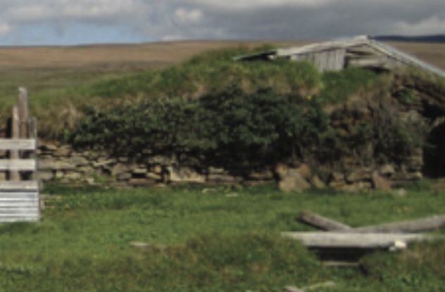
1. Sænautasel N65°15.72-W15°31.24 Although this fram was unoccupied for five years following the 1875 Askja eruption, people lived there for total of 95 years longer than anywhere else on Jökuldalsheiði. Originally, in the spring of 1843, Sænautasel was taken out of...